EarthServer
Spatio-Temporal Datacubes at Your Fingertips
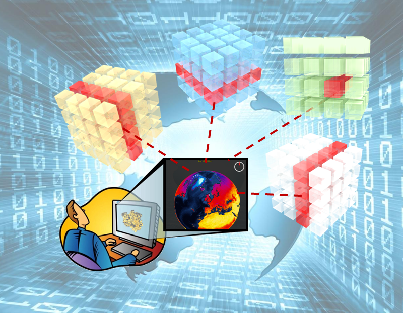
EarthServer has established client and server technology for such spatio-temporal datacubes. The underlying scalable array engine, rasdaman, en¬ables direct interaction, including 3-D visualization, what-if scenarios, common Earth Observation data processing, and general analytics. Services exclusively rely on the open OGC "Big Geo Data" standards suite, the Web Coverage Service (WCS). Phase 1 of EarthServer has advanced scalable array database technology into 100+ TB services; in Phase 2, more than 2.5 Petabyte datacubes have been built for ad-hoc extraction, processing, and fusion. In addition, Jacobs University's PlanetServer service is one of the key European portals offering datacubes on Planetary bodies like Mars, Moon, and Vesta.
Today, the EarthServer datacube federation unites a 2-digit number of large-scale Earth data providers with about 100 PB of seamlessly coupled offerings, based on the unique location-transparent federation technology of rasdaman.
However, EarthServer has not only used, but also shaped several Big Data standards. This includes OGC coverage data and service standards, INSPIRE WCS, and the ISO SQL/MDA (Multi-Dimensional Arrays) standard.
Both European Commission and reviewers observed "proven evidence" that rasdaman does "significantly transform [how to] access and use data" and "with no doubt has been shaping the Big Earth Data landscape".
Planetary-scale federation of datacubes |
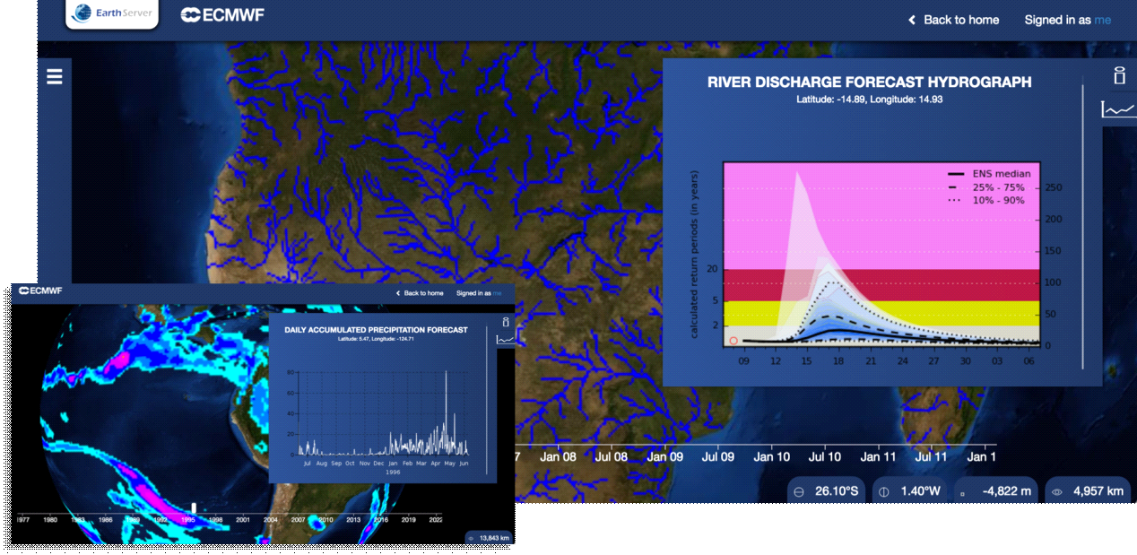
River discharge timeseries with rasdaman |
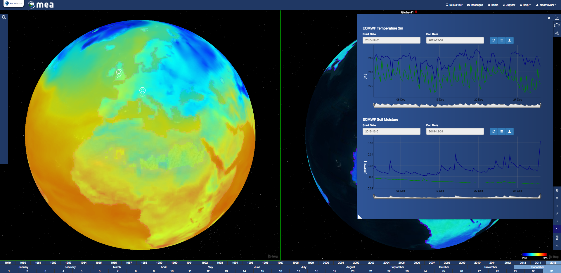
Climate indicators with rasdaman |
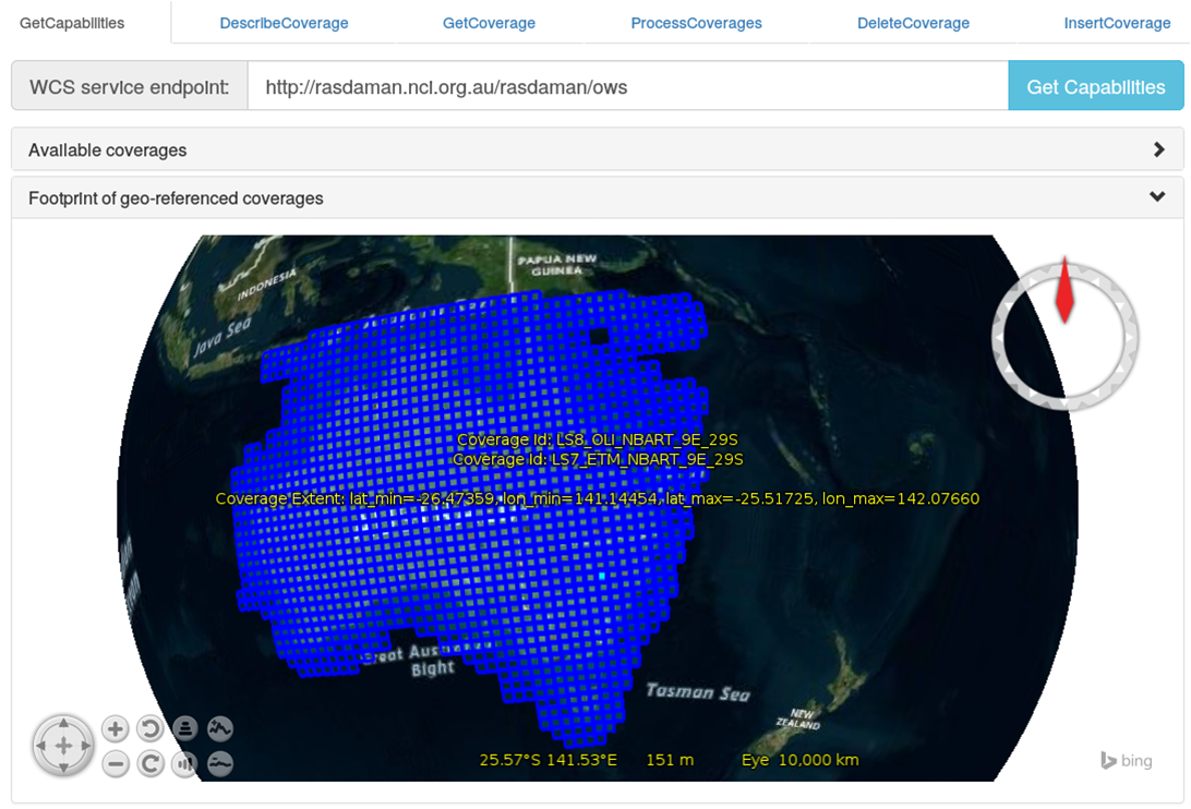
Landsat-8 satellite imagery with rasdaman |
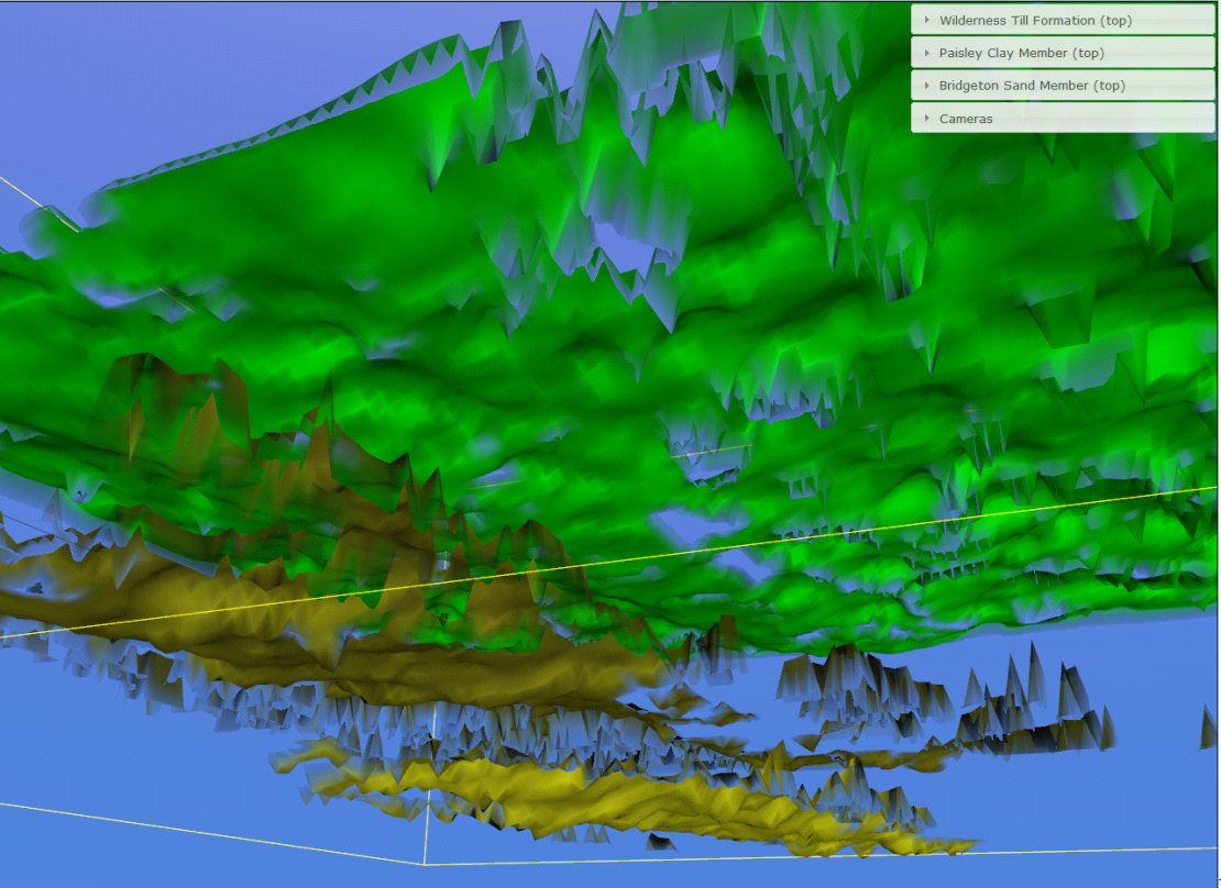
Glasgow subsurface modeling with rasdaman |

Planetary sciene services on Mars, Moon, and Vesta with rasdaman |
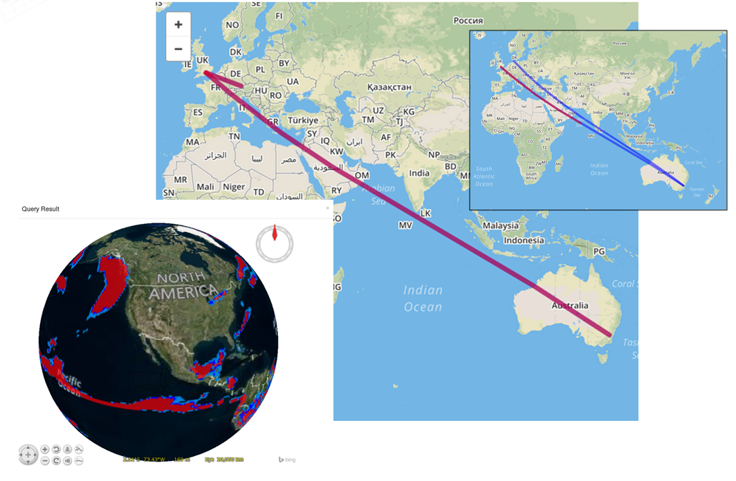
Demonstration of planetary-scale rasdaman federation: determining global heavy rain risk areas from ERA climate data at ECMWF/UK and Landsat8 data at NCI / Australia |
Contact: