Urban Geo Big Data
Urban Geo Big Data
The geoportal of the URBAN GEO BIG DATA project hosts various use cases, including the processing of Land Use and Land Cover (LULC) datasets through Open Geospatial Consortium (OGC) Web Coverage Processing Service (WCPS). The datasets are land consumption maps from Italian Institute for Environmental Protection and Research (ISPRA) of 2012, 2015, 2016, and 2017; land cover map from ISPRA of 2012; GlobeLand30 of 2000 and 2010; and GHS (Global Human Settlement) built-up of 1975, 1990, 2000, and 2014. All the datasets have a spatial extent of Italy.
When a user clicks on a dataset of multiple years, WCPS returns the change of land use or land cover classes for the clicked coordinates. Besides executing processing for a set of coordinates, WCPS also calculates the amount of change of selected land use or land cover class for an area drawn by the user for two selected years. The geoportal can be accessed via http://urbangeobigdata.como.polimi.it/. The source code with version 3 of the GNU General Public License (GPL) is available at https://github.com/kilsedar/urban-geo-big-data-3d.
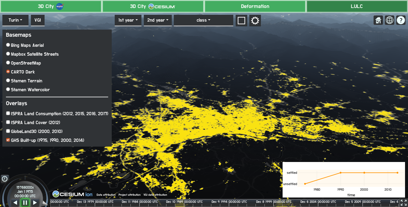
Change of classes for the clicked coordinates of GHS built-up maps from 1975 to 2014 |
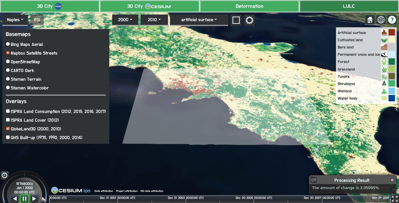
Amount of change of artificial surfaces, around 3%, for the drawn area around Campania in Italy from 2000 to 2010 according to GlobeLand30 |
Contact: